(GR 336 478 )
Directions to point I (GR 339 478)
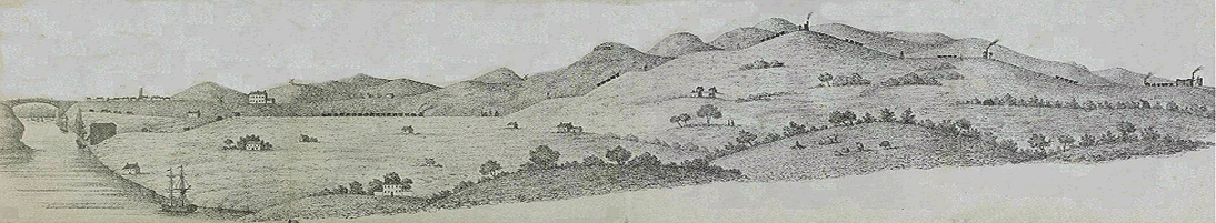
Continue along the lane and then bear right as the path continues to a small copse of trees 250 metres downhill. The trees in this area were planted as part of a reclamation scheme which occurred during the late 1970s and early 1980s. The trees on the right mask the location of the Hazard Colliery, probably the largest and most important colliery in the locality of East Rainton.
Point I QRCode or link to information 
Point H The church dedicated to St. Cuthbert in East Rainton was erected in 1866. It is a stone building built in the English style, and has a nave, a chancel and south porch and will seat 150 people. There is a burial ground attached. It was decided by order in council in the parish of West Rainton on the 10th November 1866, that the district be called “The perpetual Curacy of East Rainton”. The Bishop of Durham was invited to come to East Rainton to consecrate the church on the 19th December 1866 and thereupon the new parish of East Rainton comprising the townships of Moorsley and East Rainton was formed.
The church hall was built in 1882 by a Mr Jobling of Durham. The money was raised by sewing parties, and each member of the church and Mothers Union gave a chair for the hall.
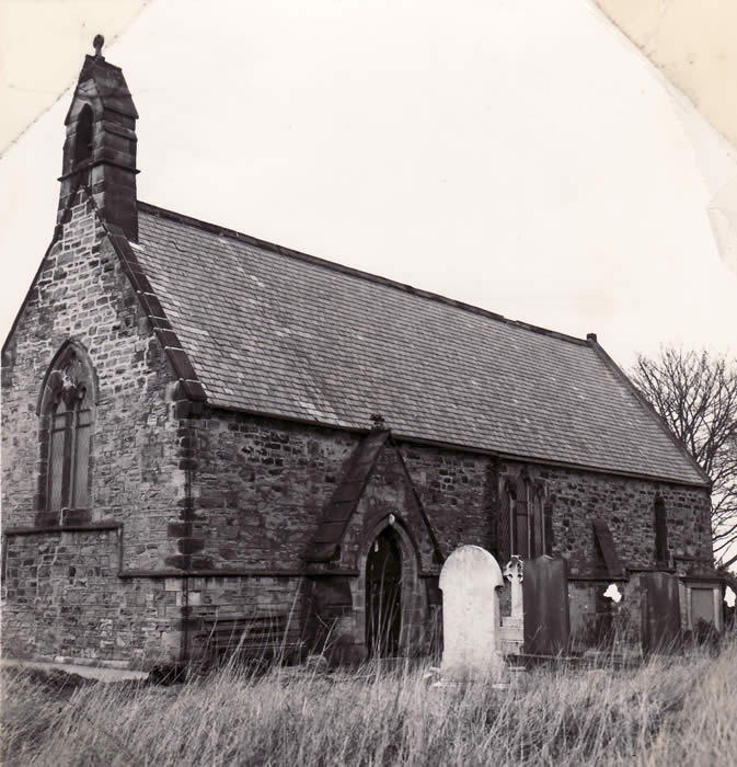 
| St Cuthbert's Church built in 1866 and still in use today. A mission church for St Cuthbert's was built in the nearby village of Moorsley. It was demolished in the 1930s |
The old church school built in 1868 just across the road from the church lasted until 1933 when it was replaced by the present school built next to it.
|
|