hetton local history group in sunderland
click here to
return to homepage

Hetton Local History Group - Boundary Heritage Walk

Point B information        

(GR 350 477 )

Directions to point C (GR 348 485)

Walk past the bowling green and tennis courts and continue along the main path via the children’s playground for 300 metres towards the point where the path starts to go uphill towards the main Houghton Road. At the bottom of the hill branch right along a small path heading into woodland. Continue on the path running close to the Hetton Beck until you come to a well-made footbridge. Cross the footbridge and keeping to the main footpath you will eventually emerge from the wood.

(Point C) QR Code or link to information


Point B The grounds of Hetton Hall were extensive. There were formal gardens just below the house together with Hetton Beck running through them and forming a water feature. The beck flowed along the valley in a northerly direction and into woodland before emerging into a boggy area later to be known as Hetton Bogs. In 1923/4 following the purchase of the property and land by Hetton Council a park was formed and renamed Hetton Welfare Park. Tennis courts and a bowling green were installed and these continue to exist today. The Welfare park was funded to a large degree with money supplied by miners who worked at the Lyons and Eppleton collieries.


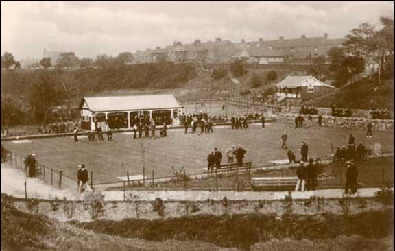
Hetton Colliery Welfare ground as it was in the 1930s. This photo concentrates on the bowling green which stilol exists today. In the background are houses on Houghton Road


-- info@hettonlocalhistory.org.uk --