MAPS
Burdon
OS map of Burdon to Seaton 1892
Chester-le-Street
OS map Chester-le-Street West 1892
Dubmire
OS map Dubmire to Shiney Row 1896
Easington Lane
OS map Easington Lane and Lyons
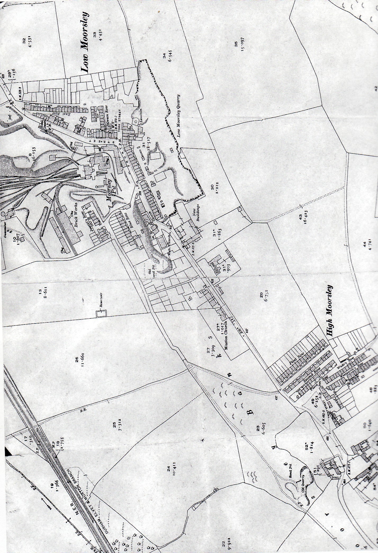
Elemore and Moorsley
OS map Elemore and High Moorsley 1892
OS map High Moorsley 1896
OS map High and Low Moorsley 1896
OS map Low Moorsley 1896
Haswell
OS map Haswell 1959
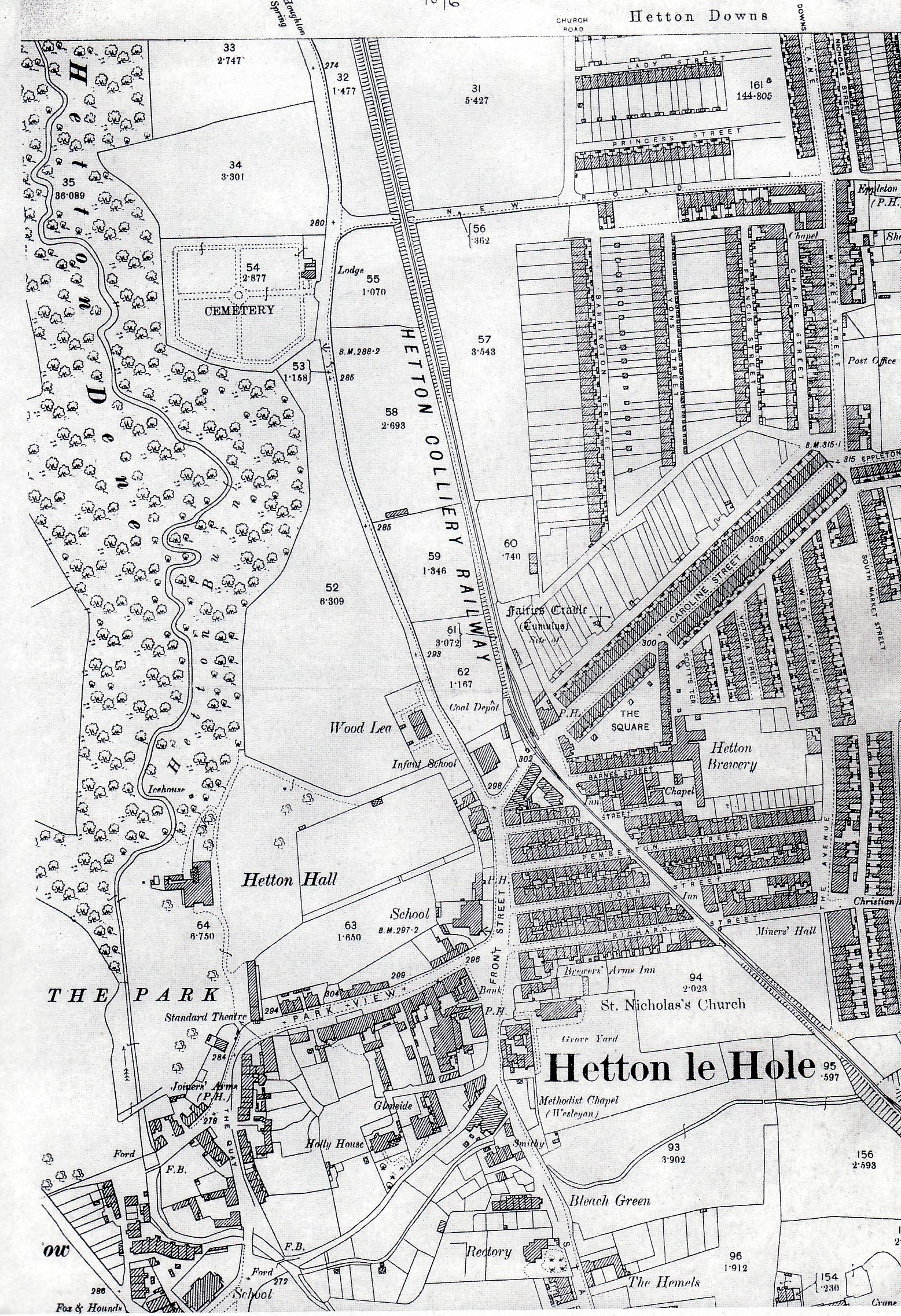
Hetton
OS map Hetton 1896
OS map Hetton Colliery Line Lyons Colliery 1896
OS map Hetton Colliery line map Lyons to Copt Hill 1896
OS map Hetton Colliery line map Eppleton Junction 1896
OS map Hetton Colliery line map Warden Law to Farringdon 1896
OS map Hetton-le-Hole 1856
OS map Hetton Hall 1856
OS map Hetton Mills 1896
|
MAPS
Houghton
OS map Houghton 1959
OS map Houghton to Philadelphia 1892
Lambton and Lumley
OS map Lambton Castle to Lumley 1892
OS map Lumley Castle Park 1892
Murton
OS map Murton 1959
Pittington
OS map Pittington 1959
OS map Pittington and Belmont 1861
OS map Pittington enlarged 1861
OS map Pittington West 1861
OS map Pittington 1951
Rainton East and West
OS map East Rainton 1895
OS map Rainton Bridge Mill 1896
OS map River Wear Kepier to Brasside 1861
OS map of Rainton Bridge Scott's Mill 1896
OS map Sherburn 1959
OS map Sherburn House 1951
OS map Shiney Row to Morton Grange 1892
OS map West Rainton 1959
Gibsons Map 1788
Land Ownership pre 1826
Thomas and Bell map north 1843
North Eastern Railway map c1920
Sunderland District and Corporation Tramways map c 1920
John Lyons Map NW quarter 1776
John Lyons Map NE quarter 1776
John Lyons Map SW quarter 1776
John Lyons Map SE quarter 1776
|
Stephenson Trail City of Sunderland 1997 map 1
Stephenson Trail City of Sunderland 1997 map 2
Stephenson Trail City of Sunderland 1997 map 3
Stephenson Trail City of Sunderland 1997 map 4
Stephenson Trail City of Sunderland 1997 map 5
County Durham Geology map
Sunderland and River Wear 1787
Sunderland and River Wear 1812
Sunderland and River Wear 1826
Bournemoor 1856 to 1865
Bournemoor 1894 to 1899
Newbottle 1894 to 1899
Collieries and railways east of Durham City
Durham Coalfield (map)
|