return to homepage
Hetton Local History Group - Boundary Heritage Walk Part 2
Point C information 
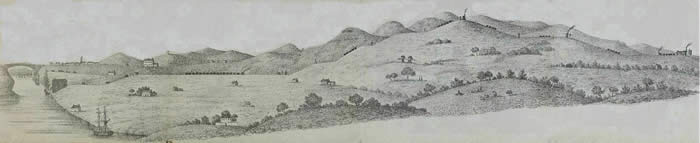
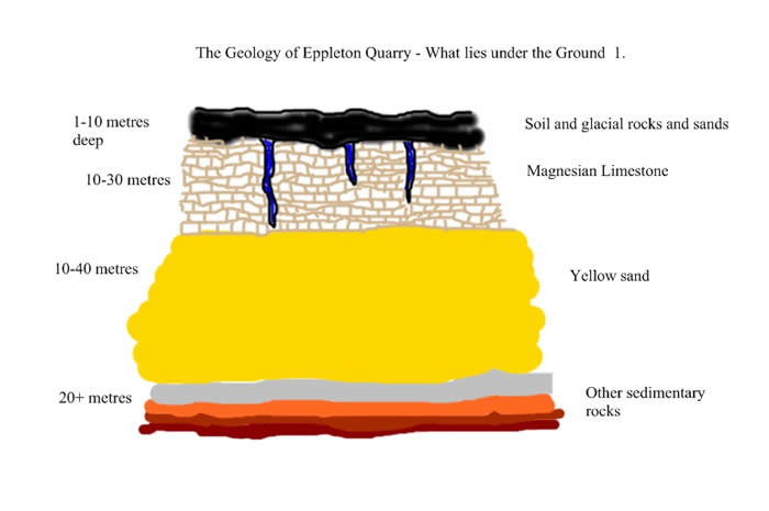
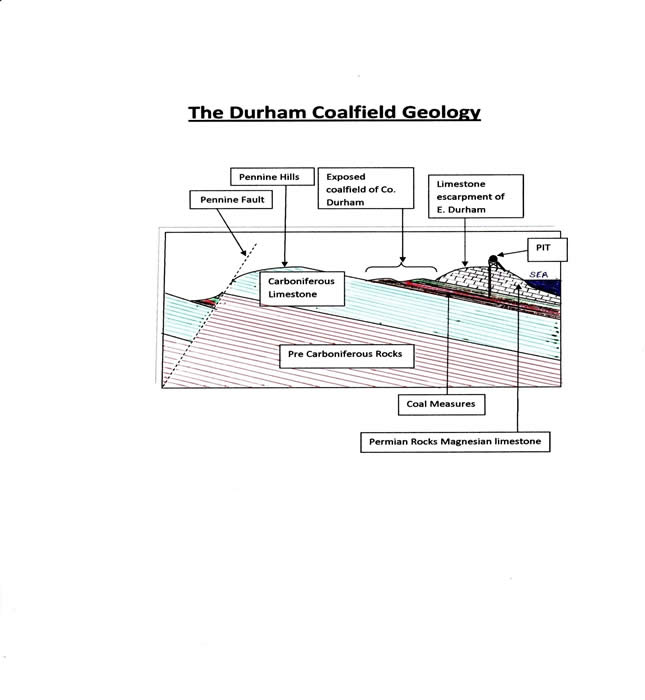
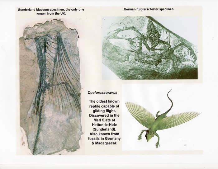
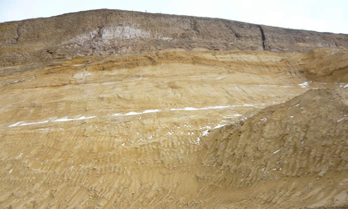
(GR 364 482 ) Directions to point D ( Point D)GR 364 482 QR code or link to information. Heritage Information Point C Look back at the quarry on the right. The quarry is private property and it is a working area so it should not be entered. This area demonstrates the earliest history of Hetton. The quarry is made up of Magnesian Limestone and yellow sand. The magnesian limestone, part of the limestone escarpment which stretches from South Shields in the north and travels south west to Ferryhill before regaining the coast north of Hartlepool.It was formed during the Permian geological period ( 290 million years ago – 240 million years ago). At that time the rocks of Hetton formed part of the Eurasian plate and were situated at the time much closer to what we would call the equator. As a result sand dunes formed much of the scenery blown around by fierce winds over many millions of years. These were eventually overlain in a shallow sea called the Zechstein Sea in which lived millions of small sea creatures whose skeletons eventually formed the magnesian limestone. The limestone bedding varies in depth between a few metres and up to 30 metres. It is generally heavily fissured at the surface and covered with a thin layer of soil and broken stones. Beneath the limestone in some locations can be found a thin layer of Marl Slate which during the geological formation signified both very shallow seas and/or coastal estuaries of rivers. There was a complete lack of oxygen in the sea at depths greater than possibly 15 metres and a layer of animal remains including some fishes settled at the bottom of the sea. The marl slate is a layer of grey mudstone laid down around 220 million years ago in shallow rivers and a shallow sea which ran over the top of some parts of the Yellow sand. The marl is present in one part of Eppleton quarry, (now covered in with colliery waste), but not in the present exposed quarry cliff. It is in this layer of marl slate that the early fish fossils can be found The fish having died and fallen to the sea bottom to be covered with sediments
|

-- info@hettonlocalhistory.org.uk --