(GR 341 472 )
Directions to point K (GR 342 466)
Having turned left along the broad track you should be travelling east in the direction of Hetton-le-Hole. You are now travelling along the track-bed of the old Durham to Sunderland Railway. Continue along this track for a kilometre walking under the Moorsley road at the start of Hetton then downhill for a short distance with the pub the Fox and Hounds on the left. When meeting the road (B1284) take care in crossing into a narrow tree-lined path gently rising to another main road. (A182).
Point K QRCode or link to information 
Point J This is the remains of the waste heap for Moorsley colliery and it has never been reclaimed although today it has in part reverted back to a more natural feature with trees and other plants growing on it.
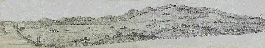
Moorsley colliery was to be found about 800 metres directly to the south on the northern slopes of the hill in that direction. It was first opened in 1821 and known as North Hetton Colliery. It closed along with the Hazard Colliery in 1934/5 following a merger in 1915. A number of the miners working at the colliery lived in East Rainton while others lived in both High and Low Moorsley. At High Moorsley there were three rows of cottages as well as others in Low Moorsley. All of the cottages were demolished during the 1950s as part of a regeneration scheme which replaced them where necessary with council properties. Initially, during the mid 19th century there were two chapels for Wesleyan and Primitive Methodists and a mission church associated with St. Cuthbert’s church at East Rainton. In 1871 a school was built in the village and provided education for 320+ children. This building, still standing alongside the hill-side road, is now a private house. One of the chapels remains, also built alongside the road leading from Low Moorsley to High Moorsley.
The following list gives an indication of the number of men and boys working at the colliery:- 1858 — 287, 1896 — 302, 1902 — 408, 1915 — 808. The total related to 1915 was the highest the colliery reached since in the same year three of the five seams, the three quarter, the five quarter and the main seam were abandoned as being worked out. The colliery then lapsed into partial closure during the years of the depression with final closure in the mid 1930s when the Hazard Colliery reached the end of its working life. Any useful coal measures were then worked from Hetton Lyons Colliery. Council properties in Low Moorsley and Peat Carr now make up the housing for the two villages.
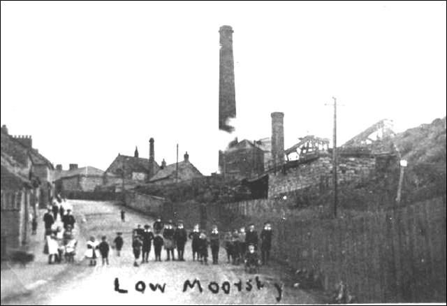 
Taken on Low Moorsley bank the colliery at Moorsley can be seen on
the right and in the far middle distance the roof of one of the two chapels.
|
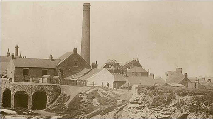
Another view of the colliery with the two shaft headgears middle right. |
|