hetton local history group in sunderland
click here to
return to homepage

Hetton Local History Group - Boundary Heritage Walk

Point D information        

(GR 344 486 )

Directions to point E (GR 341 485)

Continue along the path to the west walking close to a small pond on the right. This pond was once a mill pond held there by a brick dam with sluice gates. This structure was also part of the second later mill at Rainton Bridge. The path skirts the dam and drops to a lower level again running alongside a mill race for about 100metres near to Hetton House Woods. This race ran into a series of large ponds to the right through which the stream now flows. It is possible to see the bowl shape of the ponds. The water was then led through another mill race at the downstream end which crossed the path and then ran parallel to the path but some 30metres away to the left of the path. Keep walking through the kissing gate close to the stream which has steep eroded banks for some distance.. After about 250 metres the path meets up with a stream on the left. This is part of the mill race from the area we have just passed through as well as a supply of water coming down in a stream from the village of Hetton to the south. Just before the path reaches the main road (B1284) look at the stream bed and it is possible to see that at one time it has been lines with stone blocks.

(Point E) QR Code or link to information


Point D Next to the tree stood a house in which a miller lived; for a number of years the Scott family lived here before they moved to the larger mill at Rainton Bridge. It is difficult to ascertain whether the actual mill building straddled the stream some 40 metres to the left of the gate, since it has long since been demolished along with the house. We know that the buildings were removed in the late 1950s by the Council as they were unsafe and in poor condition. Very little remains of the mill apart from a few large blocks of sandstone which originally formed part of the structure and now lie in the stream, too large and too heavy to remove.
It is difficult to say when the mill would have been built but probably late in the 18th century. It was a corn mill and would have served the isolated farms and hamlets in the area. We know from a map of Hetton of 1776 that the mill was there. The reason for its location is easy to establish since it lies downstream from the junction of two streams, the Hetton Beck and the Rough Dene stream coming off the limestone escarpment to the east near to the Seven Sisters tumulus.


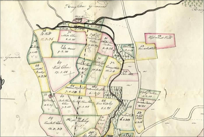
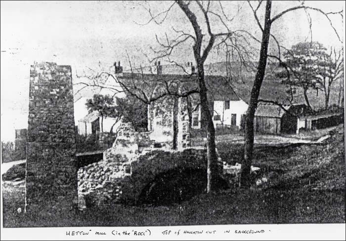
1776 map of John Lyon’s property. The mill is shown centre top lying alongside the beckside.          Picture of Hetton Mill at Hetton House Wood taken about 1950 just

                                                                                                                                                                                            before demolition


-- info@hettonlocalhistory.org.uk --